


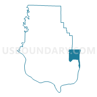
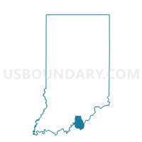
POSEY NORTHEAST, Harrison County, Indiana
About
Outline

Summary
| Unique Area Identifier | 577655 |
| Name | POSEY NORTHEAST |
| County | Harrison County |
| State | Indiana |
| Area (square miles) | 15.29 |
| Land Area (square miles) | 15.29 |
| Water Area (square miles) | 0.00 |
| % of Land Area | 99.99 |
| % of Water Area | 0.01 |
| Latitude of the Internal Point | 38.15052840 |
| Longtitude of the Internal Point | -85.93770320 |
Maps

Graphs
Select a template below for downloading or customizing gragh for POSEY NORTHEAST, Harrison County, Indiana


Neighbors
Neighoring Voting District (by Name) Neighboring Voting District on the Map
- FRANKLIN 01, Floyd County, IN
- FRANKLIN SOUTH, Harrison County, IN
- POSEY SOUTHEAST, Harrison County, IN
- POSEY WEST, Harrison County, IN
Top 10 Neighboring County Subdivision (by Population) Neighboring County Subdivision on the Map
- North Dixie CCD, Jefferson County, KY (47,912)
- South Dixie CCD, Jefferson County, KY (24,955)
- Franklin township, Harrison County, IN (4,104)
- Posey township, Harrison County, IN (2,909)
- Franklin township, Floyd County, IN (1,499)
Top 10 Neighboring Place (by Population) Neighboring Place on the Map
Top 10 Neighboring Unified School District (by Population) Neighboring Unified School District on the Map
- Jefferson County School District, KY (738,704)
- New Albany-Floyd County Consolidated Schools, IN (74,578)
- South Harrison Community Schools, IN (21,146)
- Lanesville Community School Corporation, IN (4,104)
Top 10 Neighboring State Legislative District Lower Chamber (by Population) Neighboring State Legislative District Lower Chamber on the Map
Top 10 Neighboring State Legislative District Upper Chamber (by Population) Neighboring State Legislative District Upper Chamber on the Map
- State Senate District 47, IN (128,339)
- State Senate District 46, IN (128,162)
- State Senate District 10, KY (120,533)
- State Senate District 37, KY (114,317)
Top 10 Neighboring 111th Congressional District (by Population) Neighboring 111th Congressional District on the Map
Top 10 Neighboring Census Tract (by Population) Neighboring Census Tract on the Map
- Census Tract 606, Harrison County, IN (6,881)
- Census Tract 127.03, Jefferson County, KY (6,069)
- Census Tract 605, Harrison County, IN (5,885)
- Census Tract 121.03, Jefferson County, KY (3,168)
- Census Tract 712, Floyd County, IN (2,009)
Top 10 Neighboring 5-Digit ZIP Code Tabulation Area (by Population) Neighboring 5-Digit ZIP Code Tabulation Area on the Map
- 47150, IN (47,472)
- 40272, KY (37,394)
- 40258, KY (26,465)
- 47112, IN (16,722)
- 47117, IN (4,429)
- 47136, IN (4,178)